There is a plan to develop an evacuation route that will involve the Regional District of Nanaimo, City of Parksville and Town of Qualicum Beach.
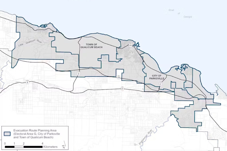
All three would collaborate on establishing an evacuation route plan for Electoral Area G (Englishman River, San Pareil, French Creek, Little Qualicum and Dashwood), Parksville and Qualicum Beach.
“There are several unique challenges when moving residents and animals to an area of safety during an emergency, particularly within an area that has both geographical and transportation route challenges," said Area G director Lehann Wallace. "By developing a plan that identifies efficient and safe evacuation routes, we can help residents be better prepared to respond to an emergency evacuation.”
Identifying local knowledge of hazards and potential evacuation barriers is vital to effective route planning. As part of the planning process, impacted and affected residents and groups are invited to provide their input through a survey until May 31. The feedback gathered will be used to help create a practical and effective evacuation plan.
Wildfires are one of the highest-ranking hazards faced by the region. Given this concern, it is critical to develop an operational evacuation route plan, especially considering recent and potential seasonal drought, continuously warming climate and the many single road access communities that exist within the project area.
The planning process will consider many factors, including risk areas, population size and demographics, transportation resources and traffic management. Other considerations include evacuation route availability and capacity, communications, animal welfare, identification of vulnerable populations, immediate emergency actions, response and evacuation times and time of year.
A Community Emergency Preparedness grant of $88,500 from the Government of British Columbia is fully funding this evacuation route planning project. The funding enables the project partners to identify strategies and alternate evacuation methods for a coordinated multi-agency evacuation response.
For more information about the project, evacuation planning resources and to sign up to receive project updates, visit getinvolved.rdn.ca/evac-route-planning-eag-cop-toqb. To provide input through the survey until May 31, Electoral Area G residents can complete the survey on the evacuation project page. City of Parksville can complete the survey at parksville.ca and Town of Qualicum Beach residents can complete the survey at bit.ly/EvacuationRoutePlanningTQB.
Residents can also learn more and provide feedback at in-person pop-up community engagement sessions in May. Visit the evacuation project page for a list of events the project team will be attending.


